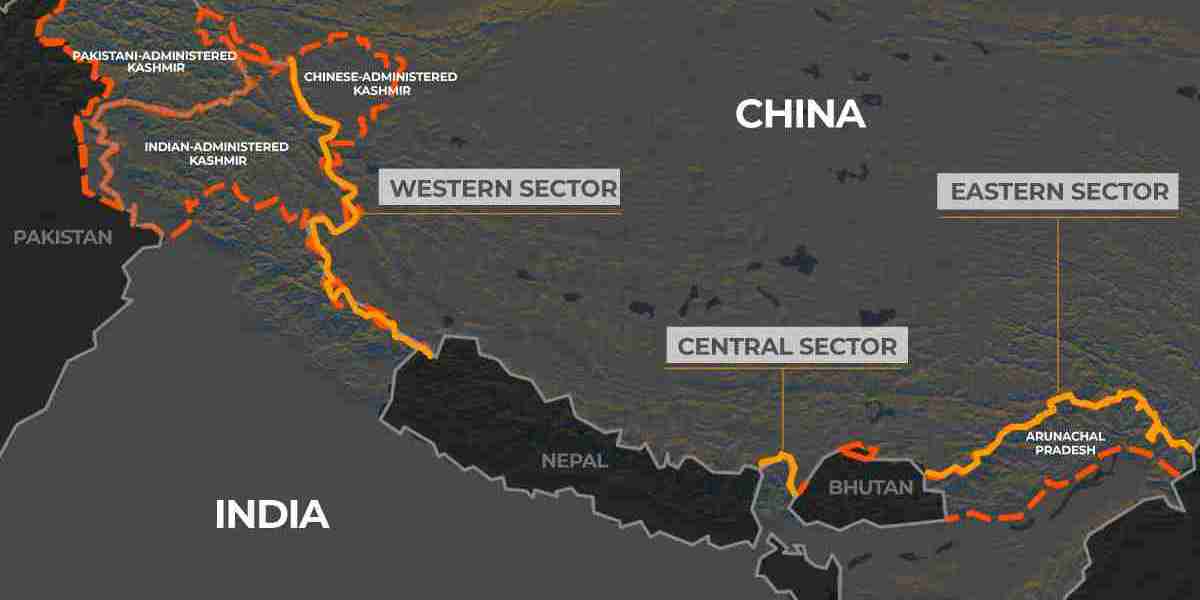
The China border with India is not only a geopolitical flashpoint but also a critical region for water-sharing agreements between the two nations. The Brahmaputra River, known as the Yarlung Tsangpo in Tibet, flows from China into India and then to Bangladesh, making it a crucial water resource. Over the years, China-India hydropolitical relations have been marked by both cooperation and contention, especially regarding data-sharing agreements for flood forecasting. While an existing Memorandum of Understanding (MoU) facilitates hydrological data sharing, its current limitations highlight the need for better mechanisms to manage transboundary water resources effectively.
The Need for Better Hydrological Data Collection
The China border with India plays a crucial role in shaping hydrological policies between the two nations. China-India hydropolitical relations could benefit from an enhanced data-sharing mechanism that incorporates additional gauging stations in high-rainfall areas. Research suggests that the majority of the Brahmaputra’s water flow is generated in the southern Himalayan region, with substantial contributions from tributaries like the Parlung Tsangpo. By establishing additional monitoring stations between Nuxia and Tuting in Arunachal Pradesh, India can receive more accurate and timely data, ultimately improving flood preparedness. Such an initiative would not only enhance disaster mitigation efforts but also foster stronger bilateral cooperation in water resource management.
The Inadequacies of the Current Data-Sharing Agreement
The existing MoU between China and India, first signed in 2002 and subsequently renewed, is aimed at providing India with flow data from hydrological stations in Tibet to aid in flood forecasting. However, the stations currently used—Nugesha, Yangcun, and Nuxia—are located in the northern Himalayan region, which experiences significantly less rainfall than the southern slopes. This geographical limitation undermines the effectiveness of the data in accurately predicting flood risks in the downstream regions of Arunachal Pradesh and Assam. The China border with India, particularly along the Brahmaputra basin, demands a more precise and inclusive approach to data collection for improved early-warning systems. China-India hydropolitical relations must evolve to incorporate more accurate methodologies for data-sharing and flood forecasting.
Strengthening China-India Hydropolitical Relations
For a more effective water-sharing framework, both nations must leverage their existing institutional mechanisms, such as the Expert Level Mechanism (ELM) on Transborder Rivers. By incorporating new gauging stations and real-time data exchange, the MoU could evolve into a more comprehensive agreement that benefits both India and China. Given the strategic importance of the Brahmaputra basin, a stronger partnership in China-India hydropolitical relations would contribute to regional stability and mutual trust. The evolving dynamics of the China border with India necessitate proactive measures to improve hydropolitical relations. Addressing the gaps in water data-sharing agreements can significantly enhance disaster management efforts and diplomatic ties. Visit the detailed article for a comprehensive analysis.


